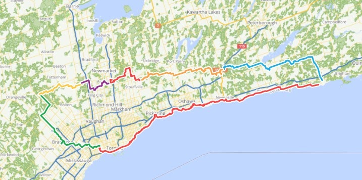
I would like to thank good friend Hal Judd for inviting me on an Oak Ridges Moraine Trail (ORMT) scouting bikepacking trip in November 2020. Hal had explored parts of the western end on some day rides and had liked the trails he found. We wanted to see if we could enjoy riding the entire length of this “hiking” trail, and quite possibly be the first to do so. What resulted was an amazing mostly off-road trails loop ride from Toronto that included the Etobicoke Creek Trail, the Oak Ridge Moraine Trail, and the Waterfront Trail. The highlight was riding the ORMT which traces the Moraine’s high ground through beautiful countryside of extensive forests and open grassland plains
Trip Summary
- 530 kilometres with 6,086 metres climbing over four days.
- Photos and Videos https://photos.app.goo.gl/ojBYd9woBrNWyu7S9
- Ride track https://ridewithgps.com/collections/15587. Requires RideWithGps account to open this collection of ride tracks. Use the ORMT Route below. Contact me if you want the Etobicoke Creek or Waterfront route gpx files.
- ORMT GPX Route https://ridewithgps.com/routes/34919250 that I created after the ride using the ORMT Guidebook maps. Public can access and download gpx file.
The Oak Ridges Moraine Trail
Excerpt from the Oak Ridges Trail Association (ORTA) http://oakridgestrail.org:
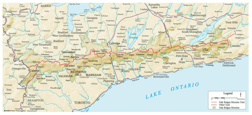
The Oak Ridges Moraine stretches for over 160 kilometres across the most populated area of Ontario. It is the source of 65 major streams or rivers and provides clean, safe drinking water to over a quarter of a million people living on the Moraine. The Moraine forest, wetlands and open meadow are vital in maintaining a healthy ecosystem for Toronto and the GTA. It also provides beautiful space for recreational use. Efforts to establish a trail along the Oak Ridges Moraine first began in 1973. At present about 275 km of main trail, plus various side trails, have been completed. The trail starts in the west at a junction with the Bruce Trail, southeast of Mono Mills (Hwy #9 & Airport Road), and extends eastward through Peel, York, and Durham Regions and Northumberland County before splitting to two gateways at Castleton (south-east) and Warkworth (east).
Please support the ORTA with your membership of only $40 per person/family and $20 per student.
Creating The Route
To create a gpx route for our trip I first contacted the Oak Ridges Trail Association to see if they had maps or a gpx file. Unfortunately their ORMT Guidebook (with detailed trail maps) was out of print and they didn’t have a gpx file to offer. An online search only found gpx files for segments of the trail. Hal said that the portion of the trail he had ridden was well marked (with white blaze marks), and so we hoped the rest of the trail was also well marked. However to be safe I used the RideWithGPS (RWG) Route Planner to create a gpx route, referencing ORTA’s very large scale overview map of the ORMT, the trails shown on RWG’s base map, and RWG’s Heat Map of RWG User trips (which is extremely useful). I completed a gpx loop route from our homes in Toronto (near Dundas and Jane) up the Etobicoke Creek trail to the ORMT western trailhead and from it’s south-eastern trailhead in Castelton back home along the Waterfront Trail. Total planned distance was about 530 kms in four to five days.
Gear
The weather forecasted was good for November, fairly low probability of precipitation (it only rained the first night), but with temperatures still dropping close to zero over-night. So we both packed our winter sleeping bags, down jacket, rain gear, and layers, as well as the usual tent etc. I also brought along my MSR PocketRocket stove for breakfast coffee and porridge.
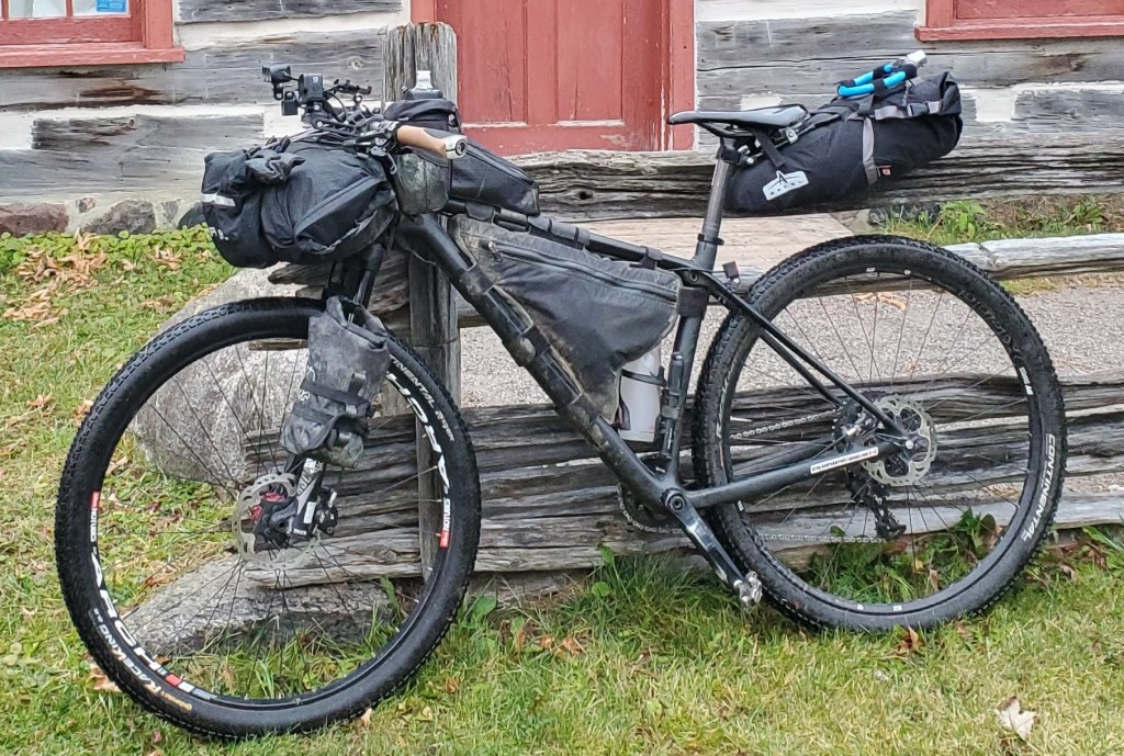
Bikes, Tires and Sand
As we knew there were some loose sandy sections we both rode our hardtail mountain bikes instead of our gravel bikes. I had Continental RaceKing 2.2” and Hal had Bontrager XR3 2.3” tires. Post trip we both wish we had wider tires. The sandy sections are near Simcoe Street (~kilometre 130k) to near Bewdley (~kilometre 200). Luckily there were only a few short sections that were bad enough to require pushing our bikes through.
The Trip – November 10th
I rode from my house to Hal’s, and then we made our way over and up the Etobicoke Creek trail network (extremely enjoyable), some country roads, and a bit of the Caledon Rail Trail. After about 70k we reach the ORMT western trailhead (southeast of Mono Mills in the Glen Haffy Conservation Area) which is marked by a large sign for “The Junction of the Oak Ridges Moraine Trail and the Bruce Trail”.

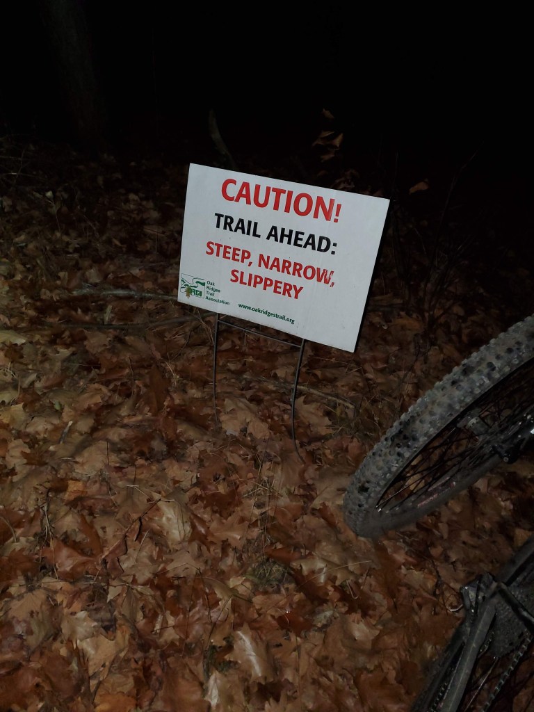
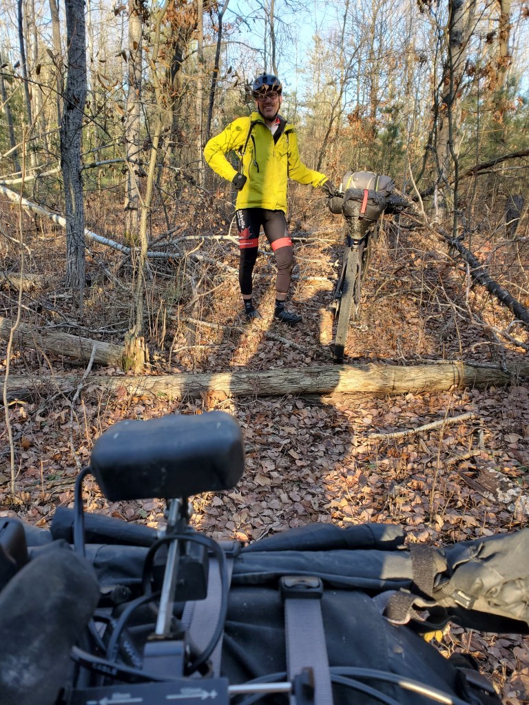
It was clear from the start that the ORMT was going to be a challenging trail ride and not an easy rail trail. Although the trail for the most part follows the crest of Moraine (left by the glaciers) there are still plenty of ascents and descents, which is tougher with a loaded bikepacking setup. After challenging single track fun through Glen Haffy, we rolled through Palgrave Forest on the easier double track.
We continued east on trails and connecting country roads. Most of the trails were enjoyable to ride. However, there was a very tough slog through some farmer fields where the route seemed only to exist on our devices and not in front of us.
We knew that on the ORMT route the 400 overpass on 16 Sideroad was closed for construction (from checking the King.ca website) and so detoured north to Portageville (refueled at a convenience store), headed east on Lloydtown-Aurora Road, and south on Jane Street to re-join the route. We bypassed (about 2k on the road) the route between Jane and Keele as it was signed “No Bicycles”. We rode through the Seneca College King Campus forest trail. We learned later that this is also signed “No Bicycles” due to forest management work. Seneca College might be an accommodation option as they rent out dorm rooms. We zigzagged through the Town of Aurora’s paved trails and roads. There are lots of restaurant and food options here. We had a great dinner and a couple of brews at Aw Shucks! There are also York Region bus and Go-Train transit options to access/leave the trail. As we approached Hwy 404 it was getting dark and rain was forecasted for the night. So instead of camping we decided to seek shelter indoors and went north on Leslie and got a room for the night at the Holiday Inn Express.

November 11th
We woke to find that it had rained overnight and was still sprinkling. We enjoyed our free breakfast, even though it was very covid style self serve in the reception area. Dressed warmly in our rain gear we headed east on the route again. Very soon we warmed up and stopped in Vandorf Park at the Whitchurch-Stouffville Museum to remove some clothing. We rode some nice trails through the many small York Region tracts of forests, including one aptly named Hal Tract.
The following is an excerpt from the ORMT Guidebook:
Whitchurch was known for its vast forest of towering white pine (upwards of 40 metres tall, and 1.5 metres in diameter) … prized for ships’ masts … By 1910, Whitchurch had been reduced to only 7% forested. …after tree cover was removed…the area became a desert wasteland of shifting sand. Ontario’s visionary Reforestation Act of 1921 … has allowed forests to recover from 7% to the present coverage of 22%.
We looped around the Town of Ballantrae. Then skirted Musselman Lake, which is one of the many glaciers created kettle lakes along the route. Musselman Lake also has a commercial campsite, a convenience store noted for its great ice cream, and a good fish restaurant. We then entered the wonderful forested areas south of Uxbridge. We took a small detour off the route to have a lunch at Coppins Corners Diner of delicious queso de dias (and an extra one to go).

As we rolled through Walker Woods and Durham Regional Forest we had to contain our urge to explore the many kilometres of additional mountain bike trails around us. After Purple Woods there is a crest in the Moraine which offers panoramic views north to Lake Scugog and south to Lake Ontario.
We took a short detour south on Old Scugog Road to Burketon Station and had dinner at Strack’s Smokin Grill, which had a wild west themed outdoor patio and bar with great food and beer.
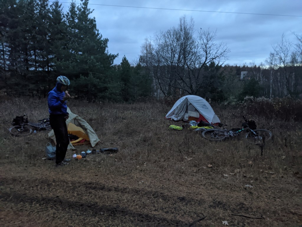
Around here we started to encounter more soft sand on the trails. This is because there was/is only a very thin layer of topsoil on the Moraine from here east. When the early farmers removed the anchoring trees and savannah grasses and ploughed the fields the topsoil was lost, leaving a sandy wasteland. Although much of the area has been reforested, any of the wider trails consists primarily of sand. We enjoyed the trails through the Long Sault Conservation Area and encountered quite a few hikers. See my route POI about this area’s specific directions for cyclists and hikers. There is supposed to be an outhouse in the park’s parking lot. We skirted the Canadian Tire Motosport Park, which celebrates its 60th birthday in 2021. When we approached Hwy 115 we decided to detour south across fields and a rough service road to get a late night snack and some breakfast food at the Tim Hortons. It was a tough 3.5 km detour but nice to have the breakfast food the next morning. We crossed under Hwy 115 using a tunnel intended only for hikers as it was blocked by a fence and huge rocks that we had to lift our bikes around and over. We then had an extremely steep hike a bike climb up the trail. Once at the top we biked a ways into the Ganaraska Forest and found a place off the trail to set up our tents for a well earned sleep. We listened to the coyotes howling as we drifted off to sleep.
November 12th
In the morning we crawled out of our sleeping bags wearing everything we could as it was near freezing. For breakfast we had our Tim’s bagel and I used my stove to make coffee and porridge. As we ate some hunters went by, looking to bag some deer…and hopefully no cyclists! My hands were really cold so I warmed them up by putting them in my pants. Turned out this was a bad idea as when I got home I got the dreaded poison ivy itch…in my crotch! The ORMT Guidebook notes “Poison Ivy grows near the trail, especially in sunny places in the east half of the Moraine. Affected skin and clothes should be washed thoroughly asap. “Leaflets three – let it be!”
Ganaraska Forest day pass or membership is required to use the trails. Purchase one online at https://www.ganaraskaforestcentre.ca/online-payments/. Be careful on the trail through the Ganaraska Forest West and East sections and they are frequented by ATVs and motorcycles. The Ganaraska Forest Centre (when open) has washroom facilities. At the centre the Ganaraska Trail heads north. The ORMT and GT share the same trail going east for about 12 kms before the GT heads south.
The ORMT Guidebook notes “The creation of the Ganaraska Forest to rehabilitate the Ganaraska River watershed is one of the most successful conservation projects in Ontario. Half the 4400 hectares (11,000 acres) has been re-forested since 1947. It’s the largest forest on the Moraine, and one of the largest in southern Ontario. The forest protects the river by restraining spring snowmelt and moderating stream flow to prevent flooding, sustaining groundwater, preventing soil erosion, and protecting water quality and fish habitat.” This is thanks to “Arthur H. Richardson’s 1942 planning survey of the Ganaraska river area. His report integrated the renewable natural resources of water, soil, forest, fish and wildlife, based on nature’s boundaries of a river’s watershed. He recommended better farming and forestry practices; reforesting 20,000 acres of the Moraine in the Ganaraska headwaters; and forming conservation authorities to manage natural resources and acquire land for protection. His study became a model for other parts of Ontario and the world.”
We could see how without the trees this area would be a sandy desert, as we rode and walked through some very soft sand on the wider trail sections that had ATV/motorcycle traffic.
Even with the sand we certainly enjoyed our ride through this huge forest. We were tempted to explore the many kms of side trails. This forest is home to one of my favourite races Paul’s Dirty Enduro, which traces a gigantic figure 8 through the Ganaraska Forest, and has been recognized by IMBA as a world class Epic race/ride.
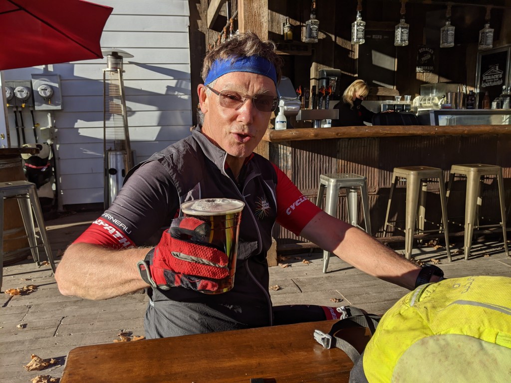
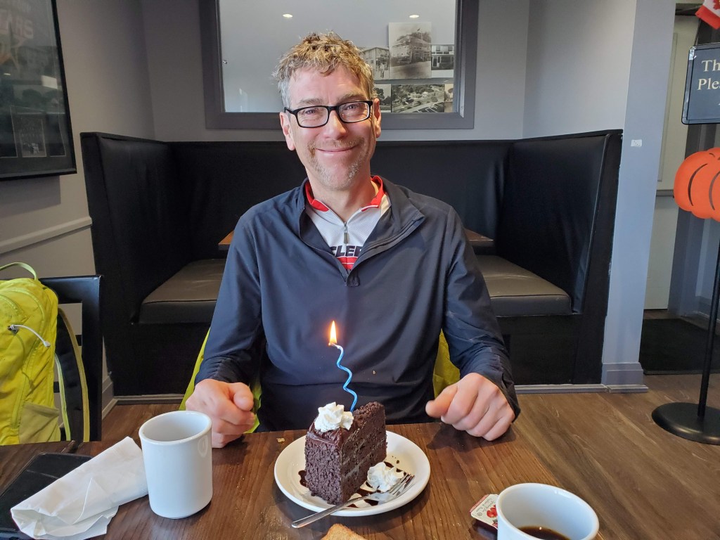
Late afternoon we arrived in Bewdley on the shores of Rice Lake. Rice Lake is 30 kms long and 4 kms wide, but only about 3 metres deep. Rice Lake was named for the wild rice which grew in it and was harvested by Mississaugas native people of the area, who also brought elderly chiefs and injured warriors to be purified in its waters. We stopped for a tasty dinner and brews at The Lakeview Bar & Grill. I surprised Hal with a slice of cake and candle to celebrate his birthday.
The route south of the lake passes through an area that once was the eastern-most large prairie in Canada, covering 200-300 square kms. On another trip I would like to explore a side-route that loops up to Rice Lake and through Gore Landing (famous for fine canoes built here) and Harwood (sight of a 4km rail bridge across the lake) before dropping back to the main trail before entering the Northumberland Forest. The large Northumberland Forest was started in 1924 with the initial planting of four million trees. Besides the main ORMT this forest is riddled with many kilometres of trails. We cross the historical Dunbar Road built during the War of 1812 to transport troops and supplies. The ORMT in the Northumberland Forest eastern section became increasingly overgrown, until we had to abandon it and follow the dirt Dunbar Road. Outside of this section we found the ORMT to be extremely well maintained and reasonably marked.
At Dawson and Morganston Roads the trail forks, with one leg going 13 kms to the eastern trailhead at Warkworth, and the other going to the south-east trailhead at Castleton. We turned south to Castleton. Although small Castleton has some interesting history. This includes it being the home in 1860 of school teacher John Macoun, who became the Dominion Botanist, cataloguing plants actress Canada and collecting 100,000 specimens. We continued south to Colbourne on Lake Ontario. We wanted to continue making some distance, but it was dark and this part of the route was on a paved road with no shoulder, so we decided to find a place to camp. Just south of Colbourne we found and took a small overgrown trail leading toward the lake. On the narrow trail we set up our tents and looked forward to some sleep before the long ride home along the Waterfront Trail. Unfortunately we were woken several times by freight trains going by on tracks about a 100 metres from us!
November 13th
The approximately 180k ride home along the Waterfront Trail was not as enjoyable as the previous days off-road trails through forests, but it was still pleasant, with many parts providing good views of Lake Ontario. The mostly paved road and trail route made for easier faster riding, although we did have a head wind most of the way. For breakfast we super filled up on good food at The Buttermilk Cafe in Cobourg. In Oshawa we couldn’t find an outdoor patio for a late lunch so we got a smoothie to go from Booster Juice. I put most of mine in my water bottle as it was just fuel to get us home.


Crossing the length of Toronto I was tired and my feet hurt. But when we turned onto the Humber River trail I found new energy to power the rest of the way home. Just in time for Friday happy hour and dinner with my sweetie!
Conclusion
Hal and I were amazed by what an amazing bikepacking experience the Oak Ridge Moraine Trail had provided. The route traces the Moraine’s high ground through beautiful countryside of extensive forests and open grassland plains. The amount and quality of trail riding is outstanding. Our rough estimate is that the trail is 60% off-road, 20% unpaved road and 20% paved road.
My ORMT GPX Route https://ridewithgps.com/routes/34919250
I created this route using the RideWithGPS (RWG) Route Planner and following the detailed route maps in the ORMT Guidebook (v6) that I found and bought on-line after our trip. I’ve included a few of the geographical and historical POIs from the guidebook (recommend you buy it for the maps and hundreds of detailed POIs), and added POIs for Camping, Caution, Control (links to optional routes etc), Convenience Stores, Food (restaurants etc), Lodging, Restroom, Viewpoint, etc. I have reviewed the route with the ORTA and included their recommended revisions (such as re-routes around “No Biking” segments). I will update this route when the ORTA publishes their ORMT Guidebook v7.

I hope someday you get to enjoy riding all or part of the Oak Ridges Moraine Trail.
Using Connecting Routes to make an Epic Ride
The ORMT is a linear route. So usually you will have to make it part of a larger loop ride. You can follow our loop trip https://ridewithgps.com/collections/15587. Or you can assemble your own epic ride from the routes (totally about 5,000 kms) that Matthew Kadey has collected and published as the ONXL: Ontario Bikepack Collective http://www.bt700.ca/onxl.html.
Cheers…Greg/
Discover more from GregRidingWithoutBorders
Subscribe to get the latest posts sent to your email.

Looks and sounds like a fun bikepacking trip.
LikeLiked by 1 person
Go riding
LikeLiked by 1 person